Description of Beautiful Places and people around world. Enjoy the discoveries!!

Wednesday, 4 April 2018

Bukapena Landowners Protest on Compensation Payment

The Legitimate Landowners of Bukapena Government Station in Mul District of Western Highlands Province have protested and call the Department of Lands and Physical Planning to put on hold to the process of gazetted compensation payment.

The protest began upon the publication of the gazetted payment for Bukapena Government Station. The landowners representative, Mr.Jacob Hon call on the Department of Lands and Physical Planning to do a proper investigation prior to payment processing. There was no proper valuation done and no landowner consultation.

If the payment is to be made for Bukapena Station then it has to be made through the Nenga Andakel Clan and no any other clan,tribe or individual.

The aggressive landowners have blocked the Bukapena Primary School gate and the Health Center and District office were interrupted by the disgruntled Nenga Andakel Clan who are the legitimate landowners of the Bukapena Government Town. They said if the payment is made to other people who have claimed it then all the Government station is mostly likely be affected.
 
News Article on Post Courier Dated March 28,2018

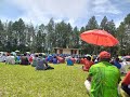
Disgruntled Landowners of Bukapena Goverment Station, The Nenga Andakel Clan members

Share:

Wednesday, 28 March 2018

BUKAPENA GOVERNMENT STATION (TOWNSHIP) IN MUL DISTRICT OF WESTERN HIGHLANDS PROVINCE.


 Bukapena Government Station is wholly surrounded by a clan well known amongst other clans/tribes in the Western Highlands called Nenga Andakel. The neighbouring clans are: Nenga Rulgump Clan, Nenga Andakomon Clan, Nenga Kumdimp Clan ,Mele Kememp Clan who are the immediate neighbouring clans for Nenga Andakel. However, the neighbouring Nenga clans including the Mele Tribe do not have any land rights or possess any interest in Bukapena Government Station. Thus, the Bukapena Government Station is situated well within the heart of Nenga Andakel Clan.

The Bukapena Village alone hosts six (6) Government Services and the legitimate landowners are the Nenga Andakel. There was no ILG ever been registered in the name of Bukapena within the Lands Department and if any ILG lodged then it is without proper landowner consultation and no proper land investigation is done.

The only six (6) government services established during colonial era are:
  • ·         Bukapena Community School (Currently Known as Bukapena Primary School).
  • ·         Mul District Headquarter & Mul LLG Council Chamber
  • ·         Bukapena Health Centre
  • ·         Bukapena Rural Police Station
  • ·         Bukapena DPI
  • ·         Bukapena Council Market.

 These Basic Government services serve almost all the people of Mul-Baiyer and part of Hagen Central District of Western Highlands Province and they become integral part of the better living standards of the rural population.

It is also known that during the colonial era, my forefathers were smart enough to bring all the vital  government services to my village without fair market value of land during compulsory customary land acquisition. Only the Nenga Andakel Clan sacrificed their customary land to allow for government services to be constructed and they are the legitimate landowners ever since and they will be for unending generations. If any claims or compensations are to be paid to Bukapena Government Station then it has to be paid to the Nenga Andakel Clan and not any other clan, tribes or individual.

On behalf of the Nenga Andakel Clan members and leaders, Mr.Jacob Hon Derk who is the Former Councillor and Clan Leader expressed the Nenga Andakel Clan’s grievances to the Department of Lands and Physical Planning on Post Courier dated 28th March 2018.  This issue arose upon a published gazetted compensation payment for the Bukapena Station which was claimed by unknown clan, tribe or individual in the Mul District of Western Highlands Province.

Mr.Hon strongly objected and boldly requested Department of Lands and Physical Planning to stop the payment process of the gazetted land compensation payment for Portions 9,409,391,254 and 1256c or whatever latest updated portion numbers of Bukapena and further request the Department of Lands & Physical Planning to further investigate on the ground the legitimate landowners of Bukapena to avoid entertaining the so called paper landowners of unknown creatures in Port Moresby.

Mr.Hon said that, Failure to stop the payment process will result in legal action(s) against these claims and he is off the view that further disturbances to the Government Services will be minimised at this level if payment process is stopped and allow proper land investigation to proceed thereon.

Mr.Hon said copies of written objections were lodged with the Department of Lands and Physical Planning via the Acting Secretary’s Office the objection was registered for deliberation.
Estimated Clan Boundaries of Nenga Oiyamp


Share:

Sunday, 10 December 2017

Hotmin Mission Station, East Sepik Province, Papua New Guinea

Hotmin is a Mission Station established by Missionaries back then and exist today which is located at the boarder of East and West Sepik Provinces in Papua New Guinea(PNG).

Hotmin is one of the remote villages in the East and West Sepik Provinces amongst other remote villages in other provinces of PNG. It lies along one of the Major Rivers in the Sepik Region known as May River. The main medium of transport is by river utilising the wooden dug-out canoes with 20-40 horsepower motors  attached at the end of the canoes. They also use wooden paddles to paddle the canoes to travel through the Rivers.
Travelling on rivers takes almost a week to reach Wewak Town which is the Capital City of East Sepik Province. They start at May River towards North-East direction to Waringai and Mowi where the May River Meets the Sepik River which is one of the Largest Rivers in PNG. Going with the current to Wewak is quite quick and easy but coming back to Hotmin is a bit of challenge for locals as they go againts the river current which needs more energy. They also have access to Vanimo if they travel upstream from Waringai along the Sepik River and exit at certain locations where they take PMVs to Vanimo Town which is the Capital City of West Sepik/Sandaun Province.

The other medium of transport to have access to Hotmin is of course by Air Transport. Fly into Hotmin by fixed wing airplanes or by choppers.  In the past the missionaries used fixed wing airplanes but this is no more in operation due to the rundown of the Hotmin Airstrip. However, choppers are flown into this village regularly by Mineral Exploration companies like Highlands Pacific, PanAust, Xrata,Niuminco, Minco and the list goes on. Flying in by chopper from Boram Airport in Wewak would take about 1 hour and 30 minutes on a good weather pattern. 
Fly  in from Kiunga or Tabubil in the Western Province which is the shortest route and would take roughly 30 to 50 minutes but this route is quite risky due to regular cloud cover and highrainfall over the Star Mountain ranges. Choppers also fly in from Mount Hagen at the Kagamuga International Airport which will take approximately  2 – 3 hours but this is not safe as it is a bit long journey.

Fly in from Frieda Airstrip of Frieda Base Camp for PanAust Limited would take about 10 to 15 minutes.

Areal Picture of Hotmin Village (Part of the Village) 

Share:

Wednesday, 6 December 2017

Tree House in New Ireland Province, Papua New Guinea

Tree Houses are built on branches of trees to serve different purposes. Some build for children to play while some build for sightseeing facilities while some build for temporary or permanent shelter.

One of the attracting views you would wish to see when you visit the New Ireland Province of Papua New Guinea is this Two Storey Tree Guest House. The Two Storey Tree Guest House for New Ireland is built along the coastline at the side of the Boluminski Highway which extends all the way to the village of Famous Tame Eels in the New Ireland Province.
From Kavieng Town you would drive South-East along Boluminski-Highway which is few meters away from the coast and along Utu Secondary School. Passing Utu Secondary School, you would see beautiful coastal villages along the highway. The Villages look much attractive as flowers of all colours bloom at any time of the day along the highway and you would really enjoy the beauty of the highway and the villages all along the highway. The highway itself is sealed and it’s in a perfect condition.

To get to the site is about half an hour drive (depend on speed) from Utu Secondary School and you would never miss this innovative structure built on a tree on your left hand side. This tree house has one bedroom and a conference table with all necessities you could ever expect from a guest house.

The first floor has one bed to accommodate one guest and the second or the top floor has conference setting with table and chairs and also a bed as well. Both floor of the tree house have verandas of about 2 meters wide which you can sit or stand or walk around to have a wonderful view of the sea and enjoy the pleasant sea breeze.  

The structure of the house is so strong that it can carry a maximum load of 20 to 30 people at a time. Almost all the materials that make up the structure are bush materials except the roofing iron and the nails.
It is very fascinating to see such a creative and yet durable structure on a white sandy beach.
Photo of Tree House in New Ireland Province, PNG.


Share:

Wednesday, 29 November 2017

Beatiful Sanaroa Island of Papua New Guinea

The Beautiful Sanaroa Island is located at just next to Ferguson Island in the Milne Bay Province of Papua New Guinea. Before you reach this Island , you have to go through East Cape from Alotau which is locate at the very tip of the PNG mainland
and you have to pass through Normanby Island and Ferguson Island.

You can either reach via Sehulea Station along Wayoko or via the passage between Ferguson and Normanby Islands. Through the passage you will definitely pass along Esaala and Dobu Island.

The island's cloudy white reef at the sea floor which dictates the colour of the sea. The colour of the see changes from dark -blue to sky-blue, green to clear. It is also a best breeding ground for tuna fish which reflects in locals catch fish at anytime when they go fishing within the coastline.

The island itself is so beautiful when you just go along the coast. The mangroves and the plants along the coast with the background of the grassland hills provides a wonderful view ever.

The clans that live in this island include but not limited to Gewale Clan, Yowana Clan , etc. and the island has a primary school which is known as Sanaroa Primary School. Government service is a great need for the people in villages. One of the common village visited by the author is Udaudana Village which lies towards East of Ferguson Island.
Sanaroa Island Via East Cape
Share:

Translate

Travellers Guides

Description of Beautiful Places and people around world. Enjoy your discoveries!!

Featured post

Hiking at Mt.Limori Yama at Minami-ku, Fukuoka Prefecture, Japan

 Hiking at Limori Yama at Minami-ku, Fukuoka Prefecture is a lot more fun. There are several routes that gets you there. Going up the hill i...